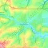
Mappa topografica Doncaster
Clicca sulla mappa per visualizzare l'altitudine.
A proposito di questa mappa

Nome: Mappa topografica Doncaster, altitudine, rilievo.
Luogo: Doncaster, South Yorkshire, England, United Kingdom (53.40574 -1.34873 53.66120 -0.86533)
Altitudine media: 31 m
Altitudine minima: -1 m
Altitudine massima: 153 m
Altre mappe topografiche
Clicca su una mappa per visualizzarne la topografia, l'altitudine e il rilievo.
Cambridge
United Kingdom > England > Cambridge
The city, like most of the UK, has a maritime climate highly influenced by the Gulf Stream. Located in the driest region of Britain, Cambridge's rainfall averages around 570 mm (22.44 in) per year, around half the national average, with some years occasionally falling into the semi-arid (under 500 mm (19.69…
Altitudine media: 18 m

Peterborough
United Kingdom > England > Cambridgeshire
The local topography is flat, and in some places, the land lies below sea level, for example in parts of the Fens to the east and to the south of Peterborough. Human settlement in the area began before the Bronze Age, as can be seen at the Flag Fen archaeological site to the east of the current city centre,…
Altitudine media: 17 m
Leeds
Lying in the eastern foothills of the Pennines, there is a significant variation in elevation within the city's built-up area. The district ranges from 1,115 feet (340 m) in the far west on the slopes of Ilkley Moor to about 33 feet (10 m) where the rivers Aire and Wharfe cross the eastern boundary. Land rises…
Altitudine media: 94 m
Plymouth
United Kingdom > England > Devon > Plymouth
The River Plym, which flows off Dartmoor to the north-east, forms a smaller estuary to the east of the city called Cattewater. Plymouth Sound is protected from the sea by the Plymouth Breakwater, in use since 1814. In the Sound is Drake's Island which is seen from Plymouth Hoe, a flat public area on top of…
Altitudine media: 81 m
Cley Hill
United Kingdom > England > Wiltshire > Corsley
Cley Hill (grid reference ST838449) is a prominent hill to the west of Warminster in Wiltshire, England. Its summit has a commanding view of the Wiltshire / Somerset county boundary, at 244 metres (801 ft) elevation. The land is in Corsley parish and is owned by the National Trust.
Altitudine media: 157 m
City of London
United Kingdom > England > City of London > City of London
The elevation of the City ranges from sea level at the Thames to 21.6 metres (71 ft) at the junction of High Holborn and Chancery Lane. Two small but notable hills are within the historic core, Ludgate Hill to the west and Cornhill to the east. Between them ran the Walbrook, one of the many "lost" rivers or…
Altitudine media: 42 m

Halifax
United Kingdom > England > Calderdale
Topographically, Halifax is located in the south-eastern corner of the moorland region called the South Pennines. Halifax is situated about 4 miles (6 km) from the M62 motorway, close to Bradford and Huddersfield. The A641 road links the town with Brighouse, Bradford and Huddersfield. The Hebble Brook joins…
Altitudine media: 195 m
Portsmouth
United Kingdom > England > Hampshire > Portsmouth
By road, Portsmouth lies 73.5 miles (118.3 km) from Central London, 49.5 miles (79.7 km) west of Brighton, and 22.3 miles (35.9 km) east of Southampton. Portsmouth is situated primarily on Portsea Island and is the United Kingdom's only island city, although parts of it have expanded onto the mainland. Gosport…
Altitudine media: 28 m

St Albans
United Kingdom > England > Hertfordshire > St Albans
St Albans was an ancient borough created following the dissolution of the monastery in 1539. It consisted of the ancient parish of St Albans (also known as the Abbey parish) and parts of St Michael and St Peter. The municipal corporation was reformed by the Municipal Corporations Act 1835 and the boundary was…
Altitudine media: 100 m

Horsenden Hill
United Kingdom > England > London
The base of this isolated hill is at an altitude of approximately 50 metres. Like all of the immediately surrounding area, the base of the hill, as well as the slopes of the hill up to about 70m, are on London Clay. Between about 70m and 80m is an isolated layer of sandier Claygate Beds. Both deposits are of…
Altitudine media: 40 m



Scarborough
United Kingdom > England > North Yorkshire
The climate is temperate with mild summers and cool, windy, winters. The hottest months of the year are July and August, with temperatures reaching an average high of 17 °C and falling to 11 °C at night. The average daytime temperatures in January are 4 °C, falling to 1 °C at night. The station's elevation…
Altitudine media: 39 m

Gateshead
United Kingdom > England > Tyne and Wear > Gateshead
One of the most distinguishing features of Gateshead is its topography. The land rises 230 feet (70 m) from Gateshead Quays to the town centre and continues rising to a height of 525 feet (160 m) at Queen Elizabeth Hospital in Sheriff Hill. This is in contrast to the flat and low lying Team Valley located on…
Altitudine media: 62 m



Accrington
United Kingdom > England > Lancashire > Hyndburn
Geographical coordinates: 53° 46' 0" North, 2° 21' 0" West. Height above sea level: there is a spot height outside the Market Hall which is 133.5 metres (438 ft) the benchmark on the side of the neighbouring Town Hall is 441.10 feet (134.45 m). The highest height in the town is 320 metres (1,050 ft) which is…
Altitudine media: 199 m




Ely
United Kingdom > England > Ely
For over 800 years the cathedral and its associated buildings—built on an elevation 68 feet (21 m) above the nearby fens—have visually influenced the city and its surrounding area. Geographer John Jones, writing in 1924, reports that "from the roof of King's Chapel in Cambridge, on a clear day, Ely can be…
Altitudine media: 13 m
Bedford
United Kingdom > England > Bedford
As with the rest of the United Kingdom, Bedford has a maritime climate, with a limited range of temperatures, and generally even rainfall throughout the year. The nearest Met Office weather station to Bedford is Bedford (Thurleigh) airport, about 6.5 miles (10.5 km) north of Bedford town centre at an elevation…
Altitudine media: 37 m

Rudyard Lake
United Kingdom > England > Staffordshire > Staffordshire Moorlands > Rudyard > Horton
Altitudine media: 205 m


Kinder Scout
United Kingdom > England > Derbyshire > High Peak
To the north across the Snake Pass lie the high moors of Bleaklow and Black Hill, which are of similar elevation.
Altitudine media: 555 m

Hull
United Kingdom > England > Kingston upon Hull
Kingston upon Hull is on the northern bank of the Humber Estuary. The city centre is west of the River Hull and close to the Humber. The city is built upon alluvial and glacial deposits which overlie chalk rocks but the underlying chalk has no influence on the topography. The land within the city is generally…
Altitudine media: 21 m


Battle of Hastings
United Kingdom > England > East Sussex > Rother > Catsfield
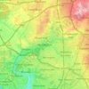
Battle Abbey was founded by William at the site of the battle. According to 12th-century sources, William made a vow to found the abbey, and the high altar of the church was placed at the site where Harold had died. More likely, the foundation was imposed on William by papal legates in 1070. The topography of…
Altitudine media: 60 m
Bathwick Hill
United Kingdom > England > Bath and North East Somerset > Bath
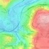
Number 1 (Bathwick Lodge) is a 2-storey villa with a steep Mansard room, built in 1825, extended in 1840 and the late C19. Probably by John Pinch the Elder.[4] Number 2 is from the early 19th century and has shutters over the windows.[11] Number 3 includes a porch which is elaborately enriched with carving,…
Altitudine media: 93 m





Redhill
United Kingdom > England > Surrey > Reigate and Banstead
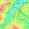
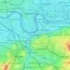
To the north, the town joins with the village of Merstham, north of which there is a "wind gap" in the chalk hills of the North Downs, at an elevation of 120 metres (390 ft) above sea level, through which the A23 road heads in from London. Geologists have speculated that there may once have been a…
Altitudine media: 107 m

Salisbury
United Kingdom > England > Salisbury
Bishop of Salisbury Hubert Walter was instrumental in the negotiations with Saladin during the Third Crusade, but he spent little time in his diocese prior to his elevation to archbishop of Canterbury. The brothers Herbert and Richard Poore succeeded him and began planning the relocation of the cathedral into…
Altitudine media: 96 m

Norton Juxta Twycross
United Kingdom > England > Leicestershire > Hinckley and Bosworth
Altitudine media: 109 m