

Mappe topografiche Massachusetts
Clicca su una mappa per visualizzarne la topografia, l'altitudine e il rilievo.


Haverhill
United States > Massachusetts > Essex County > Haverhill
According to the United States Census Bureau, the city has a total area of 35.6 square miles (92.3 km2), of which 33.0 square miles (85.4 km2) is land and 2.7 square miles (6.9 km2), or 7.47%, is water. The city ranks 60th in the Commonwealth in terms of land area, and is the largest city or town in Essex…
Altitudine media: 45 m


Ashby
United States > Massachusetts > Middlesex County
Mount Watatic was also once home to state fire tower #31 that looked out over central Massachusetts at an elevation above sea level of 1590 FT. Phone lines to the tower ran up the Ashby and Ashburnham sides of the mountain over the years.
Altitudine media: 265 m

Plainfield
United States > Massachusetts > Hampshire County
Plainfield sits 1620′ above sea level, and the peaks of West Mountain (at 2125′) are the highest elevation in Hampshire County.
Altitudine media: 484 m




Lowell
United States > Massachusetts > Middlesex County > Lowell
Lowell is located at the confluence of the Merrimack and Concord rivers. The Pawtucket Falls, a mile-long set of rapids with a total drop in elevation of 32 feet, ends where the two rivers meet. At the top of the falls is the Pawtucket Dam, designed to turn the upper Merrimack into a millpond, diverted through…
Altitudine media: 55 m

Beachwood
United States > Massachusetts > Berkshire County > Stockbridge > Beachwood
Altitudine media: 317 m


Baker Bridge
United States > Massachusetts > Middlesex County > Lincoln > Baker Bridge
Altitudine media: 62 m


Wareham
United States > Massachusetts > Plymouth County > Wareham > Wareham
Wareham was first settled in 1678 by Europeans as part of the towns of Plymouth and Rochester. It was officially incorporated in 1739 and named after the town of Wareham in England. Because of its geography, Wareham's early industry revolved around shipbuilding and the related industries. It also served as a…
Altitudine media: 10 m



Hampton Village
United States > Massachusetts > Hampden County > Westfield > Hampton Village
Altitudine media: 88 m


Beach Park
United States > Massachusetts > Plymouth County > Plymouth > Beach Park
Altitudine media: 18 m

Shrewsbury Street
United States > Massachusetts > Worcester County > Worcester
Altitudine media: 164 m


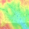


Boxboro
United States > Massachusetts > Middlesex County > Boxborough > Boxboro
Altitudine media: 99 m

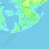


Silver Lake
United States > Massachusetts > Plymouth County > Kingston > Silver Lake
Altitudine media: 21 m


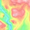


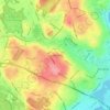










Buckland Four Corners
United States > Massachusetts > Franklin County > Buckland
Altitudine media: 346 m


