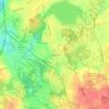
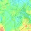
Mappa topografica Needham
Clicca sulla mappa per visualizzare l'altitudine.
Needham
Needham's area is roughly in the shape of an acute, northward-pointing triangle. The Charles River forms nearly all of the southern and northeastern boundaries, the town line with Wellesley forming the third, northwestern one. In addition to Wellesley on the northwest, Needham borders Newton and the West Roxbury section of Boston on the northeast, and Dover, Westwood, and Dedham on the south. The majority of Cutler Park is in Needham and is located along the Charles River and the border with Newton and West Roxbury. Elevations in Needham range from 85 feet above sea level at Rosemary Meadows to 180 feet at Needham Square and 300 feet at Bird's Hill.
A proposito di questa mappa
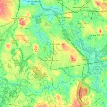
Nome: Mappa topografica Needham, altitudine, rilievo.
Luogo: Needham, Norfolk County, Massachusetts, United States (42.25484 -71.30127 42.31652 -71.18820)
Altitudine media: 46 m
Altitudine minima: 11 m
Altitudine massima: 98 m
Altre mappe topografiche
Clicca su una mappa per visualizzarne la topografia, l'altitudine e il rilievo.




Weymouth Woods
United States > Massachusetts > Norfolk County > Weymouth > South Weymouth > Pine Grove
Altitudine media: 49 m


Lake Massapoag
United States > Massachusetts > Norfolk County > Sharon
Because of the lake and the fact that Sharon is at a slightly higher elevation than the surrounding towns, and because it is located on the main rail line going south from Boston, the shores of the lake developed into a minor summer resort with several large hotels, summer camps and cottage colonies. Temple…
Altitudine media: 84 m