
Mappa topografica Yumthang
Clicca sulla mappa per visualizzare l'altitudine.
A proposito di questa mappa
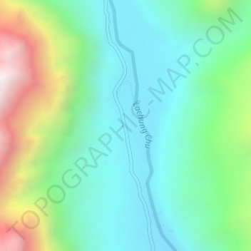
Nome: Mappa topografica Yumthang, altitudine, rilievo.
Luogo: Yumthang, Chungthang, Mangan, Sikkim, India (27.79426 88.69332 27.81426 88.71332)
Altitudine media: 3.935 m
Altitudine minima: 3.589 m
Altitudine massima: 4.816 m
Altre mappe topografiche
Clicca su una mappa per visualizzarne la topografia, l'altitudine e il rilievo.
Gurudongmar
India > Sikkim > Chungthang
Gurudongmar Lake is one of the highest lakes in the world and in India, at an elevation of 5,430 m (17,800 ft) according to the Government of Sikkim. It is located in the Great Himalayas in the Mangan District in Indian state of Sikkim, and considered sacred by Buddhists and Sikhs. The lake is named after…
Altitudine media: 5.232 m