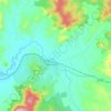
Mappa topografica Bolinda
Clicca sulla mappa per visualizzare l'altitudine.
A proposito di questa mappa

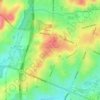
Nome: Mappa topografica Bolinda, altitudine, rilievo.
Luogo: Bolinda, Victoria, 3432, Australia (-37.45386 144.72803 -37.41386 144.76803)
Altitudine media: 377 m
Altitudine minima: 325 m
Altitudine massima: 430 m
Altre mappe topografiche
Clicca su una mappa per visualizzarne la topografia, l'altitudine e il rilievo.
City of Melbourne
Melbourne's topography is characterized by a diverse landscape that transitions from flat coastal plains to rolling hills and mountainous regions. The city is situated at the northern end of Port Phillip Bay, where the terrain is predominantly flat, facilitating urban development. As one moves eastward, the…
Altitudine media: 18 m
Melbourne
Melbourne is also prone to isolated convective showers forming when a cold pool crosses the state, especially if there is considerable daytime heating. These showers are often heavy and can include hail, squalls, and significant drops in temperature, but they often pass through very quickly with a rapid…
Altitudine media: 185 m
Melbourne
Melbourne is also prone to isolated convective showers forming when a cold pool crosses the state, especially if there is considerable daytime heating. These showers are often heavy and can include hail, squalls, and significant drops in temperature, but they often pass through very quickly with a rapid…
Altitudine media: 185 m






Macedon
Newspaper articles from the late 19th and early 20th century describe the wide variety of plants that flourished at the State Nursery in spite of its poor topsoil and craggy terrain. Cool-climate trees like cypress, larch, cedar and pine thrived at the high altitude; deciduous species of oak, ash and birch…
Altitudine media: 542 m





Horsham
Horsham's topography is flat, approximately 128 metres (420 ft) above sea level. The central business district (CBD) is laid out in a grid plan south of the train line and is characterised by wide streets and several roundabouts. Firebrace Street, running north–south through the middle of the CBD is one of…
Altitudine media: 129 m



Omeo
There are bus routes from Bright and Bairnsdale. The Bairnsdale bus runs weekdays, once both directions, and the Bright bus (Alps Link) timetable is less frequent in Summer and runs additional services during the ski season. Alps Link is the highest altitude public bus in Australia. The town sits at the…
Altitudine media: 861 m





Grampians National Park
Mount William is known within the gliding community for the "Grampians Wave", a weather phenomenon that sometimes enables glider pilots to reach extreme altitudes of the order of 28,000 ft (8,500 m). This predominantly occurs during the months of May, June, September and October when strong westerly winds flow…
Altitudine media: 262 m


Hamilton
Like most of south-western Victoria, Hamilton has a temperate mediterranean climate (Csb). Cold fronts regularly sweep in from the Southern Ocean. Although daytime temperatures occasionally reach into the 30s even 40s during summer, daytime temperatures in the mid teens will often linger into December and are…
Altitudine media: 196 m