Mappe topografiche Victoria
Clicca su una mappa per visualizzarne la topografia, l'altitudine e il rilievo.
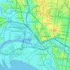
City of Melbourne
Melbourne's topography is characterized by a diverse landscape that transitions from flat coastal plains to rolling hills and mountainous regions. The city is situated at the northern end of Port Phillip Bay, where the terrain is predominantly flat, facilitating urban development. As one moves eastward, the…
Altitudine media: 18 m
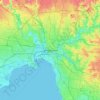
Melbourne
Melbourne is also prone to isolated convective showers forming when a cold pool crosses the state, especially if there is considerable daytime heating. These showers are often heavy and can include hail, squalls, and significant drops in temperature, but they often pass through very quickly with a rapid…
Altitudine media: 49 m


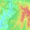


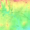


Frankston
Australia > Victoria > Frankston
Olivers Hill is the most prominent elevation in Frankston which rises to 55 metres above sea level (180 feet) at its highest point in the suburb. Its origins date to approximately 415 to 360 million years ago. Its base is Mount Eliza Granite dating from the Devonian period, which was covered in lava tuffs in…
Altitudine media: 36 m




Mount Noorat
Mount Noorat is a major volcano of the Newer Volcanics Province of Victoria, with a peak height of 310 metres above sea level and a crater between 160 and 200 metres. It is characterised by multiple vents, a complex topography, and the deepest scoria enclosed crater in Victoria. The mount illustrates a…
Altitudine media: 176 m

Rutherglen
Rutherglen features a mediterranean climate (Csa) with hot, dry summers and cool, damp winters. Climate data is sourced from Rutherglen Research; established in 1912 and still operating today. It is at an elevation of 175 metres (574 ft).
Altitudine media: 158 m



Mount Dandenong
Australia > Victoria > Melbourne
Mount Dandenong has a cool oceanic climate (Cfb), with cool to mild summers and cold, damp winters. Daytime temperatures are usually 4−6 °C cooler than downtown Melbourne due to its elevation and distance from the urban heat island effect of Melbourne. It is significantly cloudier than Melbourne,…
Altitudine media: 395 m




Tolmie
Due to its latitude and elevation, Tolmie is frequently affected by snow and chilling rains throughout much of the year. Climate data are sourced from the old Rubicon S.E.C. Sawmill at an elevation of 838 metres (2,749 ft). Tolmie is one of the coldest localities by mean maximum temperature in mainland…
Altitudine media: 692 m