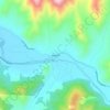
Mappa topografica Ashland
Clicca sulla mappa per visualizzare l'altitudine.
Ashland
Ashland lies within Oregon's southwest interior climate zone, in which all but the higher-elevation sites are in the rain shadow of the Oregon Coast Range to the west. The largest urban areas in this zone in addition to Ashland are Medford and Grants Pass in the Rogue Valley, and Roseburg in the Umpqua River Valley further north. Although the mountain peaks in this zone receive up to 120 inches or 3,050 millimetres of precipitation a year, the urban areas and the valleys in which they lie generally get 20 inches (510 mm) or less. This valley climate is particularly good for growing fruit, especially pears, and for producing other crops and farm goods such as hay, grain, poultry, and beef.
A proposito di questa mappa
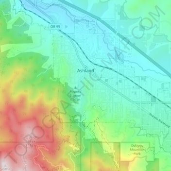
Nome: Mappa topografica Ashland, altitudine, rilievo.
Luogo: Ashland, Jackson County, Oregon, United States (42.16720 -122.73599 42.21605 -122.65110)
Altitudine media: 774 m
Altitudine minima: 503 m
Altitudine massima: 1.477 m
Altre mappe topografiche
Clicca su una mappa per visualizzarne la topografia, l'altitudine e il rilievo.

Mount McLoughlin
United States > Oregon > Jackson County
The major landmark for the Rogue River Valley, Mount McLoughlin reaches an elevation of 9,493 ft (2,893 m). The tallest volcano in between Mount Shasta — located 70 mi (110 km) to the south — and South Sister 120 miles (190 km) to the north, it lies in the Cascade Range, in the southern portion of the U.S.…
Altitudine media: 2.296 m