
Mappa topografica Cañon City
Clicca sulla mappa per visualizzare l'altitudine.
Cañon City
Cañon City is located in eastern Fremont County at 38°26′48″N 105°13′42″W / 38.44667°N 105.22833°W / 38.44667; -105.22833 (38.446800, -105.228305) at an altitude of 5,332 feet (1,625 m). It sits primarily on the north side of the Arkansas River, just east of where the river exits from Royal Gorge. It is bordered to the south by the unincorporated community of Lincoln Park. Via U.S. Route 50, Pueblo is 39 miles (63 km) to the east and Poncha Springs is 62 miles (100 km) to the west. Colorado Springs is 45 miles (72 km) to the northeast.
A proposito di questa mappa
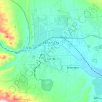
Nome: Mappa topografica Cañon City, altitudine, rilievo.
Luogo: Cañon City, Fremont County, Colorado, 81212, United States (38.38784 -105.27392 38.47835 -105.13228)
Altitudine media: 1.723 m
Altitudine minima: 1.582 m
Altitudine massima: 2.404 m
Altre mappe topografiche
Clicca su una mappa per visualizzarne la topografia, l'altitudine e il rilievo.