
Mappa topografica Caron
Clicca sulla mappa per visualizzare l'altitudine.
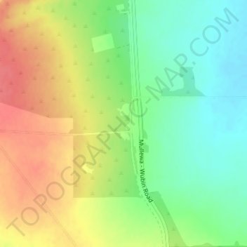
A proposito di questa mappa
Nome: Mappa topografica Caron, altitudine, rilievo.
Luogo: Caron, Shire Of Perenjori, Western Australia, Australia (-29.58792 116.30611 -29.56792 116.32611)
Altitudine media: 329 m
Altitudine minima: 301 m
Altitudine massima: 360 m
Altre mappe topografiche
Clicca su una mappa per visualizzarne la topografia, l'altitudine e il rilievo.
Darlington
Very early on, because of its altitude and separation from the Swan Coastal Plain, Darlington became established as a popular picnic area, country drive destination, and a place for holiday homes.
Altitudine media: 154 m
Kalbarri
Kalbarri is a coastal town in the Mid West region located 592 km (368 mi) north of Perth, Western Australia. The town is located at the mouth of the Murchison River, which has an elevation of 6 metres (20 ft). It is connected by public transport to Perth via Transwa coach services N1 and N2.
Altitudine media: 57 m
Rockingham
Rockingham is topographically flat, has sandy soils and coastal vegetation. It has a northern aspect to Cockburn Sound, from Rockingham Beach and Palm Beach.
Altitudine media: 4 m
Shire of Peppermint Grove
Australia > Western Australia > Shire of Peppermint Grove
Altitudine media: 16 m
Henley Brook
Henley Brook is situated on the flood plains of the Swan River, with regularly occurring seasonal floods. Two ephemeral streams from the river - Henley Brook and St. Leonard's Creek - traverse the suburb. Henley Brook is in the north-east near Brockman Street, while St Leonards Creek traverses the centre of…
Altitudine media: 28 m