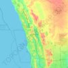
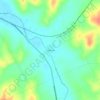
Mappa topografica Henley Brook
Clicca sulla mappa per visualizzare l'altitudine.
Henley Brook
Henley Brook is situated on the flood plains of the Swan River, with regularly occurring seasonal floods. Two ephemeral streams from the river - Henley Brook and St. Leonard's Creek - traverse the suburb. Henley Brook is in the north-east near Brockman Street, while St Leonards Creek traverses the centre of the locality in a north-westerly direction. Topographically, the north-western area is situated high up on the Gnangara Mound, reaching peaks of 45 metres above sea level, but this drops to only 7 metres in the flood plains of the western side.
A proposito di questa mappa

Nome: Mappa topografica Henley Brook, altitudine, rilievo.
Luogo: Henley Brook, City Of Swan, Western Australia, Australia (-31.83215 115.95713 -31.79134 116.01201)
Altitudine media: 28 m
Altitudine minima: 1 m
Altitudine massima: 57 m
Altre mappe topografiche
Clicca su una mappa per visualizzarne la topografia, l'altitudine e il rilievo.