
Fai una donazione
Preparati per la tua prossima avventura:
In qualità di associato Amazon, questo sito riceve una commissione sugli acquisti idonei senza alcun costo aggiuntivo per te.
Mappa topografica Northern Islands Municipality
Clicca sulla mappa per visualizzare l'altitudine.
Fai una donazione
Preparati per la tua prossima avventura:
In qualità di associato Amazon, questo sito riceve una commissione sugli acquisti idonei senza alcun costo aggiuntivo per te.
A proposito di questa mappa
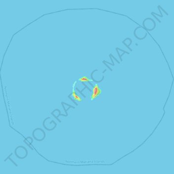
Nome: Mappa topografica Northern Islands Municipality, altitudine, rilievo.
Altitudine media: 0 m
Altitudine minima: 0 m
Altitudine massima: 200 m
Fai una donazione
Preparati per la tua prossima avventura:
In qualità di associato Amazon, questo sito riceve una commissione sugli acquisti idonei senza alcun costo aggiuntivo per te.
Altre mappe topografiche
Clicca su una mappa per visualizzarne la topografia, l'altitudine e il rilievo.
Saipan
United States > Northern Mariana Islands > Saipan Municipality > Garapan
Saipan, the largest island in the Northern Mariana Islands, features a diverse and rugged topography shaped by volcanic activity. The island's central region is dominated by Mount Tapochau, its highest peak at 1,553 feet (474 meters), providing a dramatic backdrop to the surrounding landscape. This volcanic…
Altitudine media: 22 m
Tinian Municipality
United States > Northern Mariana Islands
Tinian is about 5 nautical miles (9.3 km) southwest of Saipan, from which it is separated by the Saipan Channel. It has a land area of 39 square miles (100 km2), with its highest elevation on the Kastiyu plateau at 187 meters (614 ft). It is considerably flatter than Saipan. The island has limestone cliffs and…
Altitudine media: 5 m
Mariana Islands
United States > Northern Mariana Islands > Northern Islands Municipality
Altitudine media: 1 m
Tinian Island
United States > Northern Mariana Islands > Tinian Municipality > San Jose (Tinian)
Tinian is about 5 nautical miles (9.3 km) southwest of Saipan, from which it is separated by the Saipan Channel. It has a land area of 39 square miles (100 km2), with its highest elevation on the Kastiyu plateau at 187 meters (614 ft). It is considerably flatter than Saipan. The island has limestone cliffs and…
Altitudine media: 17 m
Fai una donazione
Preparati per la tua prossima avventura:
In qualità di associato Amazon, questo sito riceve una commissione sugli acquisti idonei senza alcun costo aggiuntivo per te.
Pagan Island
United States > Northern Mariana Islands > Northern Islands Municipality > Shomushon
Altitudine media: 35 m
Fai una donazione
Preparati per la tua prossima avventura:
In qualità di associato Amazon, questo sito riceve una commissione sugli acquisti idonei senza alcun costo aggiuntivo per te.
Tinian Island
United States > Northern Mariana Islands > Tinian Municipality > San Jose (Tinian)
Tinian is about 5 nautical miles (9.3 km) southwest of Saipan, from which it is separated by the Saipan Channel. It has a land area of 39 square miles (100 km2), with its highest elevation on the Kastiyu plateau at 187 meters (614 ft). It is considerably flatter than Saipan. The island has limestone cliffs and…
Altitudine media: 17 m
Saipan
United States > Northern Mariana Islands > Saipan Municipality > Garapan
The highest elevation on Saipan is a limestone-covered mountain called Mount Tapochau at 1,560 ft (480 m). Unlike many of the mountains in the Mariana Islands, it is not an extinct volcano but is a limestone formation.
Altitudine media: 22 m
Fai una donazione
Preparati per la tua prossima avventura:
In qualità di associato Amazon, questo sito riceve una commissione sugli acquisti idonei senza alcun costo aggiuntivo per te.
Tinian Municipality
United States > Northern Mariana Islands
Tinian is about 5 nautical miles (9.3 km) southwest of Saipan, from which it is separated by the Saipan Channel. It has a land area of 39 square miles (100 km2), with its highest elevation on the Kastiyu plateau at 187 meters (614 ft). It is considerably flatter than Saipan. The island has limestone cliffs and…
Altitudine media: 5 m
Mariana Islands
United States > Northern Mariana Islands > Northern Islands Municipality
Altitudine media: 1 m
Asuncion Island
United States > Northern Mariana Islands > Northern Islands Municipality
Altitudine media: 170 m
Fai una donazione
Preparati per la tua prossima avventura:
In qualità di associato Amazon, questo sito riceve una commissione sugli acquisti idonei senza alcun costo aggiuntivo per te.
Agrihan
United States > Northern Mariana Islands > Northern Islands Municipality
Altitudine media: 178 m