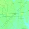
Mappa topografica Bramhapuri Town
Clicca sulla mappa per visualizzare l'altitudine.
Bramhapuri Town
Bramhapuri is one of the six divisions located in the northeastern part of Chandrapur district, Maharashtra at 20°22′N 79°31′E / 20.36°N 79.51°E / 20.36; 79.51 and has an average elevation of 229.5 metres (753 feet). The town is located in the 73rd Vidhan Sabha constituency in Maharashtra.
A proposito di questa mappa

Nome: Mappa topografica Bramhapuri Town, altitudine, rilievo.
Altitudine media: 226 m
Altitudine minima: 214 m
Altitudine massima: 244 m
Altre mappe topografiche
Clicca su una mappa per visualizzarne la topografia, l'altitudine e il rilievo.