Mappe topografiche Maharashtra
Clicca su una mappa per visualizzarne la topografia, l'altitudine e il rilievo.
Maharashtra
Maharashtra is the third largest state by area in India. The Western Ghats better known as Sahyadri, are a hilly range running parallel to the coast, at an average elevation of 1,200 metres (4,000 ft). Kalsubai, a peak in the Sahyadris, near Nashik city is the highest elevated point in Maharashtra. To the west…
Altitudine media: 478 m





Chikhaldara
The sole hill resort in the Vidarbha region, it is situated at an altitude of 1118 meters with highest elevation point 1188 meters and has the added dimension of being the only coffee-growing area in Maharashtra. Chikhaldara has an annual rainfall of 154cm. Temperatures vary from 39C in summer to 5C in winter.…
Altitudine media: 521 m





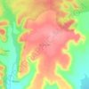


Nashik District
The entire Nashik district is underlain by the basaltic lava flows. These flows are normally horizontally disposed over a wide stretch and give rise to table land type of topography also known as a plateau. These flows occur in layered sequences and represented by massive unit at the bottom and vesicular unit…
Altitudine media: 522 m


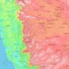
Kolhapur District
Kolhapur experiences winter from November to February. The winter temperatures are warmer than other cities in Maharashtra such as Pune and Nashik. Lows range from 9 to 16 °C (48 to 61 °F) while highs are in the range of 24 to 32 °C (75 to 90 °F) due to its high elevation and being adjacent to the Western…
Altitudine media: 464 m

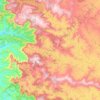


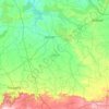


Nagpur
Nagpur is located at the exact centre of the Indian subcontinent, close to the geometric centre of the quadrilateral connecting the four major metros of India, viz. Chennai, Mumbai, New Delhi and Kolkata. The city has the Zero Mile Stone locating the geographical centre of India, which was used by the British…
Altitudine media: 309 m






Ambad
Ambad is located at 19°37′N 75°47′E / 19.62°N 75.79°E / 19.62; 75.79. It has an average elevation of 530 metres (1,740 ft).
Altitudine media: 475 m


Nashik Taluka
The city's tropical location and high altitude combine to give it a relatively mild version of a hot semi-arid climate (Köppen BSh). Temperatures rise slightly in October, but this is followed by the cool season from November to February. The cool season sees warm temperatures of around 28 °C or 82.4 °F…
Altitudine media: 631 m