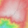
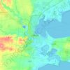
Mappa topografica Heywood
Clicca sulla mappa per visualizzare l'altitudine.
Heywood
Heywood (/ˈheɪwʊd/ HAY-wuud) is a town on the Fitzroy River in the Australian state of Victoria. It is situated at an elevation of 27 metres amidst rolling green hills in an agricultural, pastoral and timbercutting district. Heywood is 357 kilometres (222 mi) west of Melbourne at the intersection of the Princes and Henty Highways and 27 kilometres (17 mi) north of Portland. It is on the railway line to Portland, at the junction of the presently-unused branch to Mount Gambier, South Australia. The winner of several past "Tidy Town" awards, it is often referred to as the "Jewel of the Southwest".
A proposito di questa mappa

Nome: Mappa topografica Heywood, altitudine, rilievo.
Luogo: Heywood, Shire of Glenelg, Victoria, 3304, Australia (-38.20972 141.50193 -38.05652 141.78759)
Altitudine media: 63 m
Altitudine minima: 3 m
Altitudine massima: 187 m
Altre mappe topografiche
Clicca su una mappa per visualizzarne la topografia, l'altitudine e il rilievo.
Ballarat
Ballarat has a moderate oceanic climate (Köppen climate classification Cfb) with four distinct seasons. Its elevation, ranging between 400 and 630 metres (1,310 and 2,070 feet) above sea level, causes its mean monthly temperatures to tend to be on average 3 to 5 °C (5 to 9 °F) below those of Melbourne,…
Altitudine media: 470 m


Mount Dandenong
Australia > Victoria > Melbourne
Mount Dandenong has a cool oceanic climate (Cfb), with cool to mild summers and cold, damp winters. Daytime temperatures are usually 4−6 °C cooler than downtown Melbourne due to its elevation and distance from the urban heat island effect of Melbourne. It is significantly cloudier than Melbourne,…
Altitudine media: 395 m

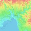
Melbourne
Melbourne is also prone to isolated convective showers forming when a cold pool crosses the state, especially if there is considerable daytime heating. These showers are often heavy and can include hail, squalls, and significant drops in temperature, but they often pass through very quickly with a rapid…
Altitudine media: 49 m



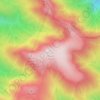


















Mount Bogong
The Big River separates the massif of the mountain from the Bogong High Plains to the south. From the nearby town of Mount Beauty to its summit, Mount Bogong rises more than 1,600 metres (5,200 ft), thus making it one of the highest peaks in Australia not only in terms of its elevation above sea level, but…
Altitudine media: 1.719 m





Buffalo Plateau
The summit of the highest peak of the plateau, known as The Horn, has an elevation of 1,723 metres (5,653 ft) AHD.
Altitudine media: 1.502 m