

Mappa topografica Edson
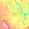
Clicca sulla mappa per visualizzare l'altitudine.
Edson
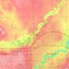
Edson lies in the McLeod River valley, immediately east of the Canadian Rockies foothills. The surrounding landscape consists of primarily taiga forest with sand hills and muskeg. The town is located at an altitude of 925 metres (3,035 ft). Two provincial parks are located west of Edson: Sundance Provincial Park along Sundance Creek and Obed Lake Provincial Park surrounding the three Obed Lakes.
A proposito di questa mappa

Nome: Mappa topografica Edson, altitudine, rilievo.
Luogo: Edson, Alberta, Canada (53.56066 -116.50735 53.59919 -116.37244)
Altitudine media: 928 m
Altitudine minima: 869 m
Altitudine massima: 988 m
Altre mappe topografiche
Clicca su una mappa per visualizzarne la topografia, l'altitudine e il rilievo.
Banff
Canada > Alberta > Banff > Banff
Banff is a town within Banff National Park in Alberta, Canada. It is located in Alberta's Rockies along the Trans-Canada Highway, approximately 126 km (78 mi) west of Calgary and 58 km (36 mi) east of Lake Louise. At 1,400 to 1,630 m (4,590 to 5,350 ft) above sea level, Banff is the community with the second…
Altitudine media: 1.615 m



Beaver Mines Lake
Canada > Alberta > Municipal District of Pincher Creek No. 9
Altitudine media: 1.538 m



Nose Hill Park
Names currently associated with topographical features in and near Nose Hill Park reflect the impact of the European newcomers and European trade goods on the Peigan. For example, Spy Hill, the westward extension of Nose Hill, derived its present name from the aboriginal practice of communicating with distant…
Altitudine media: 1.174 m


Skeleton Lake
Canada > Alberta > Summer Village of Mewatha Beach > Mewatha Beach
Altitudine media: 634 m


Grande Prairie
Canada > Alberta > Grande Prairie
Grande Prairie is located just north of the 55th parallel north, and is 465 km (289 mi) northwest of Edmonton, lying at an elevation of 669 m (2,195 ft) above sea level. The city is surrounded by farmland to the north, east, and west. To the south lies a vast boreal forest with aspen, tamarack, lodgepole pine,…
Altitudine media: 668 m


Canmore
Canada > Alberta > Town of Canmore
Elevation Place opened in April 2013 as Canmore's new recreation facility. Construction of the facility began in 2012 to replace the Canmore Recreation Centre (the community's old facility). The facility offers an 8-lane 25m lap pool, a world class climbing wall developed by Walltopia, two cardio rooms, a…
Altitudine media: 1.574 m
























Wetaskiwin
Canada > Alberta > Wetaskiwin
The city lies at an elevation of 760 m (2,490 ft). Coal Lake, a reservoir developed on the Battle River is located immediately east of the city, and other nearby waterways include Pipestone Creek, Bigstone Creek, Bittern Lake and Bearhills Lake.
Altitudine media: 770 m