
Mappa topografica Priddis
Clicca sulla mappa per visualizzare l'altitudine.
Priddis
Priddis is a hamlet in Alberta, Canada within Foothills County. It is located in the foothills of the Canadian Rockies at an elevation of 1,160 metres (3,810 ft). The hamlet is located southwest of the intersection of the Cowboy Trail (Highway 22) and Highway 22X, approximately 10 kilometres (6.2 mi) west of Calgary's city limits.
A proposito di questa mappa
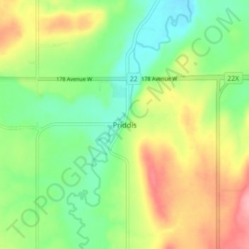
Nome: Mappa topografica Priddis, altitudine, rilievo.
Luogo: Priddis, Foothills County, Alberta, Canada (50.86479 -114.34574 50.90479 -114.30574)
Altitudine media: 1.193 m
Altitudine minima: 1.146 m
Altitudine massima: 1.262 m
Altre mappe topografiche
Clicca su una mappa per visualizzarne la topografia, l'altitudine e il rilievo.