Geolocalizza

Mappe topografiche Pixham

Clicca su una mappa per visualizzarne la topografia, l'altitudine e il rilievo.
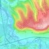
Box Hill

United Kingdom > England > Surrey > Mole Valley > Pixham

The 15.8 km (9.8 mi) Box Hill Olympic circuit is generally cycled in an anticlockwise direction and begins to the south of the village of Mickleham with an ascent of the hill via the Zig Zag Road. From the National Trust Visitor Centre, the route turns eastwards, running along the escarpment and through the…

Altitudine media: 105 m

Preparati per la tua prossima avventura:

🔦Torcia LED - Torcia potente per outdoor e sicurezza
🏕️Materassini Isolanti - Comfort superiore per dormire a terra riducendo la dispersione termica
🗺️Porta Mappe Impermeabili - Custodie trasparenti per proteggere le mappe cartacee da pioggia e fango
🚵Zaini Idrici - Sistemi di idratazione con sacca d'acqua per ciclisti e runner
⌚Orologi GPS outdoor - Orologi multisport per trekking e montagna

In qualità di associato Amazon, questo sito riceve una commissione sugli acquisti idonei senza alcun costo aggiuntivo per te.