Mappe topografiche Wake County
Clicca su una mappa per visualizzarne la topografia, l'altitudine e il rilievo.
Lake Raleigh
United States > North Carolina > Wake County > Raleigh > Isle Forest
Altitudine media: 104 m


Lake Johnson
United States > North Carolina > Wake County > Raleigh > Orchards
Altitudine media: 121 m

Prestonwood Soccer Complex
United States > North Carolina > Wake County > Cary
Altitudine media: 111 m

Harris Lake County Park
United States > North Carolina > Wake County > Hollemans Crossroads
Altitudine media: 75 m
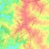

William B. Umstead State Park
United States > North Carolina > Wake County > Raleigh
Umstead is part of the Southeastern mixed forests ecoregion. The topography is hilly, and it has several artificial lakes (which are very common in Wake County, partially due to a flood control plan implemented over the last half-century).
Altitudine media: 116 m


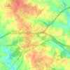
Zebulon
United States > North Carolina > Wake County
Zebulon is located in the northeast central region of North Carolina, where the North American Piedmont and Atlantic Coastal Plain regions meet. This area is known as the "Fall Line" because it marks the elevation inland at which waterfalls begin to appear in creeks and rivers. Its central Piedmont location…
Altitudine media: 91 m
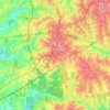
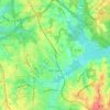
Morrisville
United States > North Carolina > Wake County
Morrisville is located in the northeast central region of North Carolina, where the North American Piedmont and Atlantic Coastal Plain regions meet. This area is known as the "Fall Line" because it marks the elevation inland at which waterfalls begin to appear in creeks and rivers. As a result, most of…
Altitudine media: 107 m
Wake Forest
United States > North Carolina > Wake County
Wake Forest is located in the northeast-central region of North Carolina, where the North American Piedmont and Atlantic Coastal Plain regions meet. This area is known as the "Fall Line" because it marks the elevation inland at which waterfalls begin to appear in creeks and rivers. Its central Piedmont…
Altitudine media: 105 m
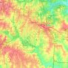
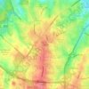
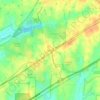
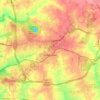
Knightdale
United States > North Carolina > Wake County
Knightdale is located in the northeast central region of North Carolina, where the North American Piedmont and Atlantic Coastal Plain regions meet. This area is known as the "Fall Line" because it marks the elevation inland at which waterfalls begin to appear in creeks and rivers. Its central Piedmont location…
Altitudine media: 84 m
Wendell
United States > North Carolina > Wake County
Wendell is located in the northeast-central region of North Carolina, where the Piedmont and Atlantic Coastal Plain regions meet. This area is known as the "Fall Line" because it marks the elevation inland at which rapids and small waterfalls begin to appear in creeks and rivers. Its central Piedmont location…
Altitudine media: 90 m
Cary
United States > North Carolina > Wake County
Cary is seated on the boundary between the Durham Basin with its softer sedimentary rocks and the piedmont with its harder metamorphic rocks; both geologic provinces have igneous rock intrusions. The landscape is typically gentle to moderate sloping hills separated by narrow V-shaped valleys, but there are…
Altitudine media: 111 m
Fuquay-Varina
United States > North Carolina > Wake County
Fuquay-Varina is located in the northeast central region of North Carolina, where the North American Piedmont and Atlantic Coastal Plain regions meet. This area is known as the "Fall Line" because it marks the elevation inland at which waterfalls begin to appear in creeks and rivers. Its central Piedmont…
Altitudine media: 113 m
Raleigh
United States > North Carolina > Wake County
Raleigh is located in the northeast central region of North Carolina, where the Piedmont and Atlantic coastal plain regions meet. This area is known as the "fall line" because it marks the elevation inland at which waterfalls begin to appear in creeks and rivers. As a result, most of Raleigh features gently…
Altitudine media: 103 m