
Fai una donazione
Preparati per la tua prossima avventura:
In qualità di associato Amazon, questo sito riceve una commissione sugli acquisti idonei senza alcun costo aggiuntivo per te.
Mappa topografica Great Basin
Clicca sulla mappa per visualizzare l'altitudine.
Fai una donazione
Preparati per la tua prossima avventura:
In qualità di associato Amazon, questo sito riceve una commissione sugli acquisti idonei senza alcun costo aggiuntivo per te.
Great Basin
The Great Basin is the largest area of contiguous endorheic watersheds, those with no outlets, in North America. It spans nearly all of Nevada, much of Utah, and portions of California, Idaho, Oregon, Wyoming, and Baja California. It is noted for both its arid climate and the basin and range topography that varies from the North American low point at Badwater Basin in Death Valley to the highest point of the contiguous United States, less than 100 miles (160 km) away at the summit of Mount Whitney. The region spans several physiographic divisions, biomes, ecoregions, and deserts.
Fai una donazione
Preparati per la tua prossima avventura:
In qualità di associato Amazon, questo sito riceve una commissione sugli acquisti idonei senza alcun costo aggiuntivo per te.
A proposito di questa mappa
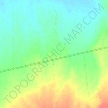
Nome: Mappa topografica Great Basin, altitudine, rilievo.
Luogo: Great Basin, Eureka County, Nevada, United States (39.49995 -116.50005 39.50005 -116.49995)
Altitudine media: 1.918 m
Altitudine minima: 1.896 m
Altitudine massima: 1.952 m
Fai una donazione
Preparati per la tua prossima avventura:
In qualità di associato Amazon, questo sito riceve una commissione sugli acquisti idonei senza alcun costo aggiuntivo per te.