
Fai una donazione
Preparati per la tua prossima avventura:
In qualità di associato Amazon, questo sito riceve una commissione sugli acquisti idonei senza alcun costo aggiuntivo per te.
Mappa topografica Clearfield
Clicca sulla mappa per visualizzare l'altitudine.
Fai una donazione
Preparati per la tua prossima avventura:
In qualità di associato Amazon, questo sito riceve una commissione sugli acquisti idonei senza alcun costo aggiuntivo per te.
Clearfield
Clearfield City has a total land area of 7.8 square miles (20 km2), and a population of 31,909 as of the 2020 Census, making it the fifth largest city in Davis County, behind Layton, Bountiful, Kaysville, and Syracuse. This creates a population density of 1498.1 people per square kilometer or 3860.5 people per square mile. Clearfield City has an average elevation of 4,327 feet (1,319 m) above sea level. The lowest point within the boundaries of the city is 4,314 feet (1,315 m) at the intersection of 1000 West and Antelope Drive on the city's western edge, and the highest is 4,711 feet (1,436 m) at a point that is within the city's northeast corner but physically located on Hill Air Force Base property along Constitution Way in their housing area. (AGRC)
Fai una donazione
Preparati per la tua prossima avventura:
In qualità di associato Amazon, questo sito riceve una commissione sugli acquisti idonei senza alcun costo aggiuntivo per te.
A proposito di questa mappa
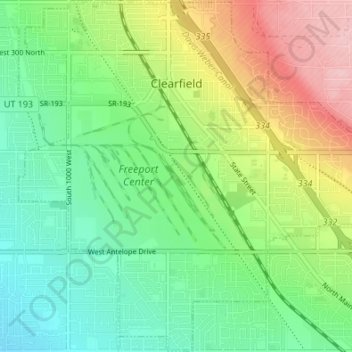
Nome: Mappa topografica Clearfield, altitudine, rilievo.
Luogo: Clearfield, Davis County, Utah, United States (41.07476 -112.05495 41.12536 -111.98717)
Altitudine media: 1.358 m
Altitudine minima: 1.300 m
Altitudine massima: 1.460 m
Fai una donazione
Preparati per la tua prossima avventura:
In qualità di associato Amazon, questo sito riceve una commissione sugli acquisti idonei senza alcun costo aggiuntivo per te.
Altre mappe topografiche
Clicca su una mappa per visualizzarne la topografia, l'altitudine e il rilievo.
Antelope Island
United States > Utah > Davis County
The island is accessible via a 7-mile causeway from Syracuse in Davis County. Access from Interstate 15 is via exit 332, then west along Antelope Drive (SR-108). The island's shore (all but west side of the island) is mostly flat with beaches and plains to the base of the mountains on the island. These steep…
Altitudine media: 1.306 m
Fai una donazione
Preparati per la tua prossima avventura:
In qualità di associato Amazon, questo sito riceve una commissione sugli acquisti idonei senza alcun costo aggiuntivo per te.
Fai una donazione
Preparati per la tua prossima avventura:
In qualità di associato Amazon, questo sito riceve una commissione sugli acquisti idonei senza alcun costo aggiuntivo per te.
Mount Lebannon Acres
United States > Utah > Davis County > Centerville > Rosedale
Altitudine media: 1.464 m
Fai una donazione
Preparati per la tua prossima avventura:
In qualità di associato Amazon, questo sito riceve una commissione sugli acquisti idonei senza alcun costo aggiuntivo per te.