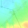
Mappa topografica Baladiya
Clicca sulla mappa per visualizzare l'altitudine.
A proposito di questa mappa

Nome: Mappa topografica Baladiya, altitudine, rilievo.
Luogo: Baladiya, Bhuj Taluka, Kachchh, Gujarat, 370427, India (23.09426 69.60892 23.09775 69.61180)
Altitudine media: 153 m
Altitudine minima: 129 m
Altitudine massima: 205 m
Altre mappe topografiche
Clicca su una mappa per visualizzarne la topografia, l'altitudine e il rilievo.
Bhuj
India > Gujarat > Bhuj Taluka
Bhuj has an average elevation of 110 metres (360 feet). On the eastern side of the city is a hill known as Bhujia Hill, on which there is a Bhujia Fort, that separates Bhuj city and Madhapar town ( considered one of the richest villages in Asia ). It has two lakes namely Hamirsar and Deshadsar (દેેેશળસર).
Altitudine media: 130 m





Bhuj
India > Gujarat > Bhuj Taluka
Bhuj has an average elevation of 110 metres (360 feet). On the eastern side of the city is a hill known as Bhujia Hill, on which there is a Bhujia Fort, that separates Bhuj city and Madhapar town ( considered one of the richest villages in Asia ). It has two lakes namely Hamirsar and Deshadsar (દેેેશળસર).
Altitudine media: 130 m
Bhuj
India > Gujarat > Bhuj Taluka
Bhuj has an average elevation of 110 metres or 360 feet. On the eastern side of the city is a hill known as Bhujia Hill, on which there is a Bhujia Fort, that separates Bhuj city and Madhapar town (considered one of the richest villages in Asia). It has two lakes namely Hamirsar Lake and Deshadsar (દેેેશળસર).
Altitudine media: 130 m
Bhuj
India > Gujarat > Bhuj Taluka
Bhuj has an average elevation of 110 metres (360 feet). On the eastern side of the city is a hill known as Bhujia Hill, on which there is a Bhujia Fort, that separates Bhuj city and Madhapar town ( considered one of the richest villages in Asia ). It has two lakes namely Hamirsar Lake and Deshadsar (દેેેશળસર).
Altitudine media: 130 m