
Mappa topografica Col du Lautaret
Mappa interattiva
Clicca sulla mappa per visualizzare l'altitudine.
A proposito di questa mappa
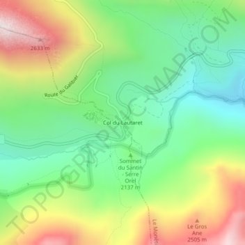
Nome: Mappa topografica Col du Lautaret, altitudine, rilievo.
Altitudine media: 2.261 m
Altitudine minima: 1.804 m
Altitudine massima: 3.117 m
From the west, the climb starts at Les Clapier, near Le Bourg-d'Oisans, from where the climb is 34.2 km (21.3 mi) long, gaining 1,312 m (4,304 ft) in altitude, at an average gradient of 3.8%, with the steepest section being at 7.5% in the first kilometre.