
Fai una donazione
Preparati per la tua prossima avventura:
In qualità di associato Amazon, questo sito riceve una commissione sugli acquisti idonei senza alcun costo aggiuntivo per te.
Mappa topografica Irby
Clicca sulla mappa per visualizzare l'altitudine.
Fai una donazione
Preparati per la tua prossima avventura:
In qualità di associato Amazon, questo sito riceve una commissione sugli acquisti idonei senza alcun costo aggiuntivo per te.
A proposito di questa mappa
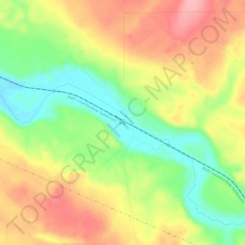
Nome: Mappa topografica Irby, altitudine, rilievo.
Luogo: Irby, Lincoln County, Washington, United States (47.33931 -118.87111 47.37931 -118.83111)
Altitudine media: 477 m
Altitudine minima: 416 m
Altitudine massima: 537 m
Fai una donazione
Preparati per la tua prossima avventura:
In qualità di associato Amazon, questo sito riceve una commissione sugli acquisti idonei senza alcun costo aggiuntivo per te.
Altre mappe topografiche
Clicca su una mappa per visualizzarne la topografia, l'altitudine e il rilievo.
Wilbur
United States > Washington > Lincoln County
Wilbur is situated in an oblong basin with Goose Creek, also named for Wild Goose Bill, running through the center of the town, and abrupt, basaltic cliffs, not of very great elevation, on the north and south. At one time this spot was, evidently, a lake. During the construction of U.S. Route 2, the course of…
Altitudine media: 680 m
Fai una donazione
Preparati per la tua prossima avventura:
In qualità di associato Amazon, questo sito riceve una commissione sugli acquisti idonei senza alcun costo aggiuntivo per te.
Creston
United States > Washington > Lincoln County
Creston sprang up with the arrival of the Central Washington Railroad in 1889. It was so named because of its high altitude; it was thought to be at the highest point (the crest) between Cheney and Coulee City, Washington, along the railroad grade. In the spring of 1890, a town site was platted by H.S. Huson…
Altitudine media: 752 m
Wilbur
United States > Washington > Lincoln County
Wilbur is situated in an oblong basin with Goose Creek, also named for Wild Goose Bill, running through the center of the town, and abrupt, basaltic cliffs, not of very great elevation, on the north and south. At one time this spot was, evidently, a lake. During the construction of U.S. Route 2, the course of…
Altitudine media: 680 m
Fai una donazione
Preparati per la tua prossima avventura:
In qualità di associato Amazon, questo sito riceve una commissione sugli acquisti idonei senza alcun costo aggiuntivo per te.