
Mappa topografica Ambuklao Dam
Mappa interattiva
Clicca sulla mappa per visualizzare l'altitudine.
A proposito di questa mappa
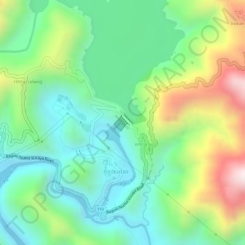
Nome: Mappa topografica Ambuklao Dam, altitudine, rilievo.
Altitudine media: 808 m
Altitudine minima: 598 m
Altitudine massima: 1.190 m
SNAP-Benguet began a massive rehabilitation project that restored Ambuklao to operating status and increased its capacity from 75 MW to 105 MW. The project required the construction of a new intake, headrace and penstock, elevation of tailrace tunnel outlet, de-silting of tailrace tunnel and replacement of electro-mechanical components. In June 2011, Unit 3 became the first turbine unit to go on-line, followed by the other two units. Ambuklao was formally inaugurated in October 2011.