
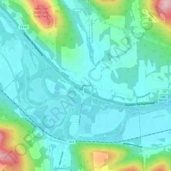
Mappa topografica Lowman
Mappa interattiva
Clicca sulla mappa per visualizzare l'altitudine.
A proposito di questa mappa
Nome: Mappa topografica Lowman, altitudine, rilievo.
Altitudine media: 290 m
Altitudine minima: 238 m
Altitudine massima: 479 m
Altre mappe topografiche
Clicca su una mappa per visualizzarne la topografia, l'altitudine e il rilievo.
West Elmira
United States > New York > Chemung County
West Elmira, Town of Elmira, Chemung County, New York, 14905, United States
Altitudine media: 320 m
Brand Park
United States > New York > Chemung County > City of Elmira
Brand Park, City of Elmira, Chemung County, New York, United States
Altitudine media: 270 m
City of Elmira
United States > New York > Chemung County > City of Elmira
City of Elmira, Ashland, Chemung County, New York, United States
Altitudine media: 296 m
Village of Millport
United States > New York > Chemung County
Village of Millport, Town of Veteran, Chemung County, New York, United States
Altitudine media: 296 m
Langdon Hill
United States > New York > Chemung County
Langdon Hill, Chemung County, New York, 14838, United States
Altitudine media: 449 m
Village of Horseheads
United States > New York > Chemung County
Village of Horseheads, Town of Horseheads, Veteran, Chemung County, New York, 14845, United States
Altitudine media: 298 m