
Mappa topografica Falls Creek
Mappa interattiva
Clicca sulla mappa per visualizzare l'altitudine.
A proposito di questa mappa
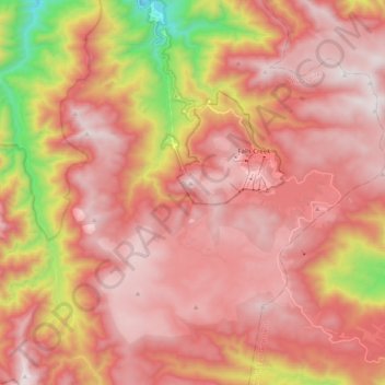
Nome: Mappa topografica Falls Creek, altitudine, rilievo.
Altitudine media: 1.459 m
Altitudine minima: 629 m
Altitudine massima: 1.892 m
The Falls Creek Alpine Resort is an alpine ski resort in the Hume region in northeastern Victoria, Australia. It is located in the Alpine National Park in the Victorian Alps, approximately 350 kilometres (220 miles) by road from Melbourne, with the nearest town Mount Beauty, approximately 30 km (20 mi) away. The resort lies between an elevation of 1,210 and 1,830 m (3,970 and 6,004 ft) above sea level, with the highest lifted point at 1,780 m (5,840 ft). Skiing is possible on the nearby peak of Mount McKay at 1,842 m (6,043 ft), accessed by snowcat from the resort.