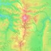
Mappa topografica Mount Jefferson
Clicca sulla mappa per visualizzare l'altitudine.
Mount Jefferson
The second tallest mountain in the U.S. state of Oregon after Mount Hood, Mount Jefferson lies within Jefferson, Linn, and Marion counties, in the central part of the state. Reaching an elevation of 10,497 feet (3,199 m), the volcano has a proximal relief of 4,890 feet (1,490 m). It is not usually visible from the city of Portland, though it is visible on clear days from Salem and can be noticed from highways to both the east and the west of the Cascade Range. The average elevation of the terrain around Jefferson is 5,500 to 6,500 feet (1,700 to 2,000 m), meaning that Jefferson's cone rises nearly 1 mile (1.6 km) above its surroundings.
A proposito di questa mappa
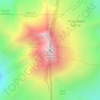
Nome: Mappa topografica Mount Jefferson, altitudine, rilievo.
Luogo: Mount Jefferson, Jefferson County, Oregon, United States (44.67428 -121.79964 44.67438 -121.79954)
Altitudine media: 2.537 m
Altitudine minima: 2.002 m
Altitudine massima: 3.156 m
Altre mappe topografiche
Clicca su una mappa per visualizzarne la topografia, l'altitudine e il rilievo.