
Mappa topografica Adimali
Clicca sulla mappa per visualizzare l'altitudine.
Adimali
Adimaly generally has a cool climate throughout the year, typical of the higher altitudes, though not as cold as Munnar. Temperatures rarely exceed 26 degrees and never drop below 10 degrees as it usually stays around 17-24 degrees. December and January are cooler than other months. Adimaly is a place with heavy rainfall mostly throughout the year and it is heaviest during the June–September season of southwest monsoon. Rains in Adimaly sometimes continue for hours or even days without any dry spell, which may bring the town to a standstill.
A proposito di questa mappa
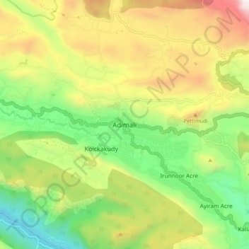
Nome: Mappa topografica Adimali, altitudine, rilievo.
Luogo: Adimali, Devikulam, Idukki, Kerala, 685561, India (9.97443 76.91546 10.05443 76.99546)
Altitudine media: 786 m
Altitudine minima: 177 m
Altitudine massima: 1.633 m
Altre mappe topografiche
Clicca su una mappa per visualizzarne la topografia, l'altitudine e il rilievo.