
Mappa topografica Gundagai
Mappa interattiva
Clicca sulla mappa per visualizzare l'altitudine.
A proposito di questa mappa
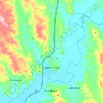
Nome: Mappa topografica Gundagai, altitudine, rilievo.
Altitudine media: 309 m
Altitudine minima: 208 m
Altitudine massima: 622 m
Gundagai is an inland town with an elevation of 250 metres (820 ft). Almost all of the shire is located in the South West Slopes bio-region and is part of the Riverina agricultural region. The eastern part of the shire is considered part of the South Eastern Highlands bioregion.