
Mappa topografica Osijek
Mappa interattiva
Clicca sulla mappa per visualizzare l'altitudine.
A proposito di questa mappa
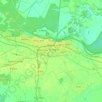
Nome: Mappa topografica Osijek, altitudine, rilievo.
Luogo: Osijek, Grad Osijek, Osijek-Baranja County, Croatia (45.51407 18.59620 45.58006 18.78136)
Altitudine media: 87 m
Altitudine minima: 78 m
Altitudine massima: 101 m
Osijek (Croatian pronunciation: (listen)) is the fourth largest city in Croatia with a population of 108,048 in 2011. It is the largest city and the economic and cultural centre of the eastern Croatian region of Slavonia, as well as the administrative centre of Osijek-Baranja County. Osijek is located on the right bank of the river Drava, 25 kilometres (16 mi) upstream of its confluence with the Danube, at an elevation of 94 metres (308 ft).