Mappa topografica Aidlingen
Clicca sulla mappa per visualizzare l'altitudine.
Aidlingen
The municipality (Gemeinde) of Aidlingen is found in the district of Böblingen, in the German state of Baden-Württemberg. Aidlingen lies on the western edge of Böblingen district, along its border with Calw's district, and physically in the Heckengäu and the Upper Gäu [de] regions. The main watercourse in the municipal area is the Würm, which flows north-to-west through the eastern portion of the municipality. The lowest elevation above sea level in the municipal area, 403 meters (1,322 ft) Normalnull (NN), is found along the Würm. The highest, 576 meters (1,890 ft) NN, is near Dachtal.
A proposito di questa mappa
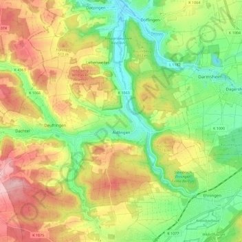
Nome: Mappa topografica Aidlingen, altitudine, rilievo.
Altitudine media: 481 m
Altitudine minima: 399 m
Altitudine massima: 580 m
Altre mappe topografiche
Clicca su una mappa per visualizzarne la topografia, l'altitudine e il rilievo.