

Mappa topografica Acushnet
Clicca sulla mappa per visualizzare l'altitudine.
Acushnet
Acushnet lies along the Acushnet River and its tributaries, including the Keene River and Squinn Brook, which feed the New Bedford Reservoir, in turn feeding the Acushnet. The Acushnet River is the town line between it and New Bedford south of Main Street. There are several other ponds in the town, including Hamlin's Mill Pond (along the Acushnet), East Pond and a portion of Tinkham Pond, which lies along the Mattapoisett town line. The town lies within the coastal plain, mostly below 80 feet (24 m) elevation, with higher points around Mendon and Perry Hills in the southeast of town and in the Sassaquin area in the northwest corner of town, where the highest point in town rises slightly above 160 feet (49 m) above sea level. Most of the town's population lies along the New Bedford line, with the biggest area being in the southwest corner of the town, near the town hall.
A proposito di questa mappa
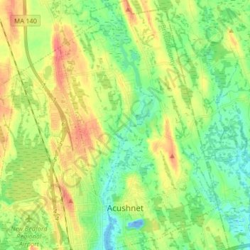
Nome: Mappa topografica Acushnet, altitudine, rilievo.
Altitudine media: 21 m
Altitudine minima: -22 m
Altitudine massima: 50 m