
Mappa topografica Marton
Clicca sulla mappa per visualizzare l'altitudine.
A proposito di questa mappa
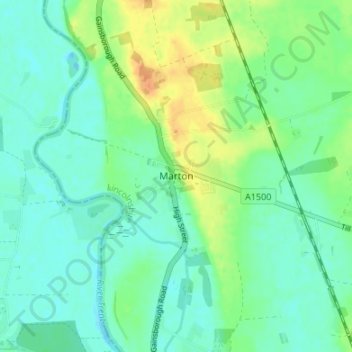
Nome: Mappa topografica Marton, altitudine, rilievo.
Altitudine media: 12 m
Altitudine minima: -4 m
Altitudine massima: 36 m
Altre mappe topografiche
Clicca su una mappa per visualizzarne la topografia, l'altitudine e il rilievo.
Welton CP
United Kingdom > England > Lincolnshire > West Lindsey
The parish stretches from the ancient Ermine Street (A15) in the west, following a north-easterly shape to the Barlings Eau at its eastern end, of which the Welton Beck is a tributary, and is an example of a strip parish. Due to the low, flat topography of Lincolnshire, land had to be drained for agriculture…
Altitudine media: 27 m
Rase Park
United Kingdom > England > Lincolnshire > West Lindsey > Market Rasen
Altitudine media: 28 m
North Willingham CP
United Kingdom > England > Lincolnshire > West Lindsey > North Willingham CP
Altitudine media: 82 m
Corringham CP
United Kingdom > England > Lincolnshire > West Lindsey > Corringham CP
Altitudine media: 21 m