
Fai una donazione
Preparati per la tua prossima avventura:
In qualità di associato Amazon, questo sito riceve una commissione sugli acquisti idonei senza alcun costo aggiuntivo per te.
Mappa topografica Aberdeen
Clicca sulla mappa per visualizzare l'altitudine.
Fai una donazione
Preparati per la tua prossima avventura:
In qualità di associato Amazon, questo sito riceve una commissione sugli acquisti idonei senza alcun costo aggiuntivo per te.
A proposito di questa mappa
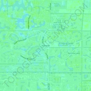
Nome: Mappa topografica Aberdeen, altitudine, rilievo.
Luogo: Aberdeen, Palm Beach County, Florida, 33437, United States (26.53063 -80.16866 26.57063 -80.12866)
Altitudine media: 9 m
Altitudine minima: 4 m
Altitudine massima: 12 m
Fai una donazione
Preparati per la tua prossima avventura:
In qualità di associato Amazon, questo sito riceve una commissione sugli acquisti idonei senza alcun costo aggiuntivo per te.
Altre mappe topografiche
Clicca su una mappa per visualizzarne la topografia, l'altitudine e il rilievo.
Loxahatchee Groves
United States > Florida > Palm Beach County
The area now known as Loxahatchee Groves was originally a portion of the 2,000,000 acres (8,100 km2) of land purchased by the Southern States Land and Timber Company in 1902. After the West Palm Beach Canal (C-51), which connected Lake Okeechobee at Canal Point to West Palm Beach, was completed in 1917, George…
Altitudine media: 9 m
Fai una donazione
Preparati per la tua prossima avventura:
In qualità di associato Amazon, questo sito riceve una commissione sugli acquisti idonei senza alcun costo aggiuntivo per te.
Fai una donazione
Preparati per la tua prossima avventura:
In qualità di associato Amazon, questo sito riceve una commissione sugli acquisti idonei senza alcun costo aggiuntivo per te.
Fai una donazione
Preparati per la tua prossima avventura:
In qualità di associato Amazon, questo sito riceve una commissione sugli acquisti idonei senza alcun costo aggiuntivo per te.
Lake Clarke Shores
United States > Florida > Palm Beach County
In the early 1930s, Zeb Vance Hooker and his family became the first settlers in modern-day Lake Clarke Shores by squatting in a wooden shack on land by the southeast side of Lake Clarke. In 1946, Patsy Renolds built a house where Antigua Road stands today and is the oldest home in Lake Clarke Shores. By the…
Altitudine media: 8 m
Fai una donazione
Preparati per la tua prossima avventura:
In qualità di associato Amazon, questo sito riceve una commissione sugli acquisti idonei senza alcun costo aggiuntivo per te.
Morikami Museum and Japanese Gardens
United States > Florida > Palm Beach County > Delray Beach
Altitudine media: 9 m