Fai una donazione
Preparati per la tua prossima avventura:
In qualità di associato Amazon, questo sito riceve una commissione sugli acquisti idonei senza alcun costo aggiuntivo per te.
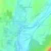
Mappa topografica Peru
Clicca sulla mappa per visualizzare l'altitudine.
Fai una donazione
Preparati per la tua prossima avventura:
In qualità di associato Amazon, questo sito riceve una commissione sugli acquisti idonei senza alcun costo aggiuntivo per te.
Peru
Peru is located in northeastern Bennington County, bordered by Rutland County to the north. The crest of the Green Mountains runs from north to the south through the western half of the town, traversed by the Long Trail/Appalachian Trail. 3,300-foot-high (1,000 m) Bromley Mountain and its ski area are in the southern part of the town, and 3,392-foot (1,034 m) Styles Peak and 3,428-foot (1,045 m) Peru Peak are to the north. The village or town center of Peru is in the southeastern part of town, at elevation 1,706 feet (520 m). Vermont Route 11 crosses the southeastern part of the town, through the town center and past Bromley Mountain Ski Area.
Fai una donazione
Preparati per la tua prossima avventura:
In qualità di associato Amazon, questo sito riceve una commissione sugli acquisti idonei senza alcun costo aggiuntivo per te.
A proposito di questa mappa
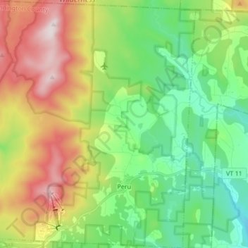
Nome: Mappa topografica Peru, altitudine, rilievo.
Luogo: Peru, Bennington County, Vermont, 05152, United States (43.20542 -72.97959 43.30416 -72.85991)
Altitudine media: 595 m
Altitudine minima: 341 m
Altitudine massima: 1.036 m
Fai una donazione
Preparati per la tua prossima avventura:
In qualità di associato Amazon, questo sito riceve una commissione sugli acquisti idonei senza alcun costo aggiuntivo per te.
Altre mappe topografiche
Clicca su una mappa per visualizzarne la topografia, l'altitudine e il rilievo.


Fai una donazione
Preparati per la tua prossima avventura:
In qualità di associato Amazon, questo sito riceve una commissione sugli acquisti idonei senza alcun costo aggiuntivo per te.

Fai una donazione
Preparati per la tua prossima avventura:
In qualità di associato Amazon, questo sito riceve una commissione sugli acquisti idonei senza alcun costo aggiuntivo per te.