
Mappa topografica Phoenix
Clicca sulla mappa per visualizzare l'altitudine.
Phoenix
Phoenix is in the south-central portion of Arizona; about halfway between Tucson to the southeast and Flagstaff to the north, in the southwestern United States. By car, the city is approximately 150 miles (240 kilometers) north of the US–Mexico border at Sonoyta and 180 mi (290 km) north of the border at Nogales. The metropolitan area is known as the "Valley of the Sun" due to its location in the Salt River Valley. It lies at a mean elevation of 1,086 feet (331 m), in the northern reaches of the Sonoran Desert.
A proposito di questa mappa
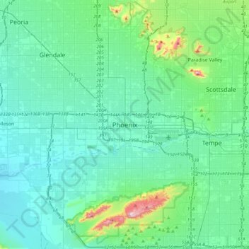
Nome: Mappa topografica Phoenix, altitudine, rilievo.
Altitudine media: 368 m
Altitudine minima: 292 m
Altitudine massima: 813 m
Altre mappe topografiche
Clicca su una mappa per visualizzarne la topografia, l'altitudine e il rilievo.