
Mappa topografica Blue Grass
Mappa interattiva
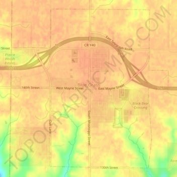
Clicca sulla mappa per visualizzare l'altitudine.
A proposito di questa mappa
Nome: Mappa topografica Blue Grass, altitudine, rilievo.
Altitudine media: 239 m
Altitudine minima: 208 m
Altitudine massima: 246 m
Altre mappe topografiche
Clicca su una mappa per visualizzarne la topografia, l'altitudine e il rilievo.
Davenport
United States > Iowa > Scott County
Davenport, Scott County, Iowa, United States
Altitudine media: 205 m
Park View
United States > Iowa > Scott County
Park View, Scott County, Iowa, United States
Altitudine media: 235 m
Buffalo
United States > Iowa > Scott County
Buffalo, Buffalo Township, Scott County, Iowa, 52728, United States
Altitudine media: 205 m
Sheridan Township
United States > Iowa > Scott County
Sheridan Township, Scott County, Iowa, 52748, United States
Altitudine media: 231 m
Bettendorf
United States > Iowa > Scott County > Pleasant Valley Township
Bettendorf, Pleasant Valley Township, Scott County, Iowa, 52722, United States
Altitudine media: 207 m
Pleasant Valley Township
United States > Iowa > Scott County
Pleasant Valley Township, Scott County, Iowa, United States
Altitudine media: 198 m
Le Claire
United States > Iowa > Scott County
Le Claire, Le Claire Township, Scott County, Iowa, United States
Altitudine media: 200 m
Walcott
United States > Iowa > Scott County > Walcott
Walcott, Blue Grass Township, Scott County, Iowa, United States
Altitudine media: 227 m
Eldridge
United States > Iowa > Scott County
Eldridge, Sheridan Township, Scott County, Iowa, 52748, United States
Altitudine media: 234 m
Davenport
United States > Iowa > Scott County > Davenport
Davenport, Scott County, Iowa, 52801, United States
Altitudine media: 212 m
Long Grove
United States > Iowa > Scott County
Long Grove, Scott County, Iowa, United States
Altitudine media: 235 m