
Mappa topografica Kirandul
Clicca sulla mappa per visualizzare l'altitudine.
Kirandul
The Kothavalasa–Kirandul line of East Coast Railway from Kirandul to Visakhapatnam via Koraput is laid through the Eastern Ghats. Up to Araku station, it has many tunnels. Also it pass through the highest elevation Broad gauge station in the Eastern ghats, Semiliguda, just before the Borra caves. Kirandul - Kottavalasa Railroad is the record high Broad Gauge line in the Eastern Ghats. The KK Line has the distinction of being the second highest broad gauge railway line in the country after the one in Jammu.
A proposito di questa mappa
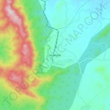
Nome: Mappa topografica Kirandul, altitudine, rilievo.
Altitudine media: 742 m
Altitudine minima: 541 m
Altitudine massima: 1.270 m