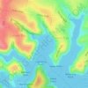
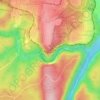
Mappa topografica Thornleigh
Clicca sulla mappa per visualizzare l'altitudine.
Thornleigh
Thornleigh is bounded to the north by Waitara Creek and south by the Lane Cove National Park. Thornleigh borders the suburbs of Normanhurst, Hornsby, Wahroonga, Westleigh and Pennant Hills. Thornleigh offers great district views, and the topography varies greatly with many established areas built around bushland settings and into the hills to afford the great views. The northern areas of the suburb bounded by Larool Creek and Waitara Creek are leafy and lush with vegetation and native fauna including rainbow lorikeets, kookaburras, cockatoos, and bush turkeys. Majorie Headen Lookout is a vantage point which overlooks Larool and Waitara Creek Valley. The area bounded near the train station and the Comenarra Parkway include early examples of Federation and Californian Bungalow style properties.
A proposito di questa mappa

Nome: Mappa topografica Thornleigh, altitudine, rilievo.
Luogo: Thornleigh, Sydney, New South Wales, 2120, Australia (-33.73919 151.06940 -33.70531 151.09263)
Altitudine media: 159 m
Altitudine minima: 72 m
Altitudine massima: 197 m
Altre mappe topografiche
Clicca su una mappa per visualizzarne la topografia, l'altitudine e il rilievo.

Nielsen Park
Australia > New South Wales > Sydney
As is common in all coastal and estuarine areas of the Sydney Region, the Park contains many rock outcrops, particularly along the foreshore headlands. These are given some added interest by the remnants of the effect of a basalt dyke that runs from Mount Trefle to Bottle and Glass Point resulting in the…
Altitudine media: 14 m







Prospect Hill
Australia > New South Wales > Sydney
As at 19 February 2001, the Prospect Hill area had state significance due to its unique combination of significant landscape feature, potential archaeological site, and association with important historical phases. As a dolerite outcrop rising to a height of 117 metres (384 ft) AHD , Prospect Hill is a rare…
Altitudine media: 65 m

























Bents Basin State Conservation Area
Australia > New South Wales > Sydney
The park is popular for swimming, kayaking, bushwalking, camping (with 100 tent sites), barbecuing, picnicking and fishing. The park also features walking trails within a bushland and an education centre with a commercial kitchen. Caley's Lookout Track, a walking track within the bushland, leads to Little…
Altitudine media: 82 m