

Mappa topografica Winter Hill
Clicca sulla mappa per visualizzare l'altitudine.
Winter Hill
Paths to the summit lead from Belmont (in Blackburn with Darwen), Rivington (in Chorley), and Horwich and Blackrod (in Bolton). The summit can also be reached via a short walk from the top of a road pass 1+1⁄4 miles (2 km) west of Belmont. The hill is a prominent natural landmark on the skyline for the most of Chorley and further afield. Winter Hill's topographic prominence results in it being classified as a Marilyn. The trig point on its summit marks the highest point in Blackburn with Darwen whereas the highest point in Bolton is 440 yards (400 m) away on its south east slope at 1,467 feet (447 m) above sea level.
A proposito di questa mappa
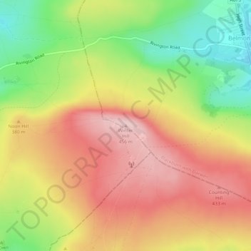
Nome: Mappa topografica Winter Hill, altitudine, rilievo.
Altitudine media: 357 m
Altitudine minima: 236 m
Altitudine massima: 456 m