
Mappa topografica Tablelands
Clicca sulla mappa per visualizzare l'altitudine.
A proposito di questa mappa
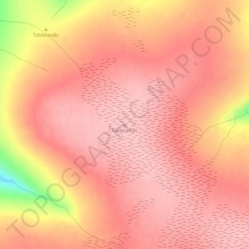
Nome: Mappa topografica Tablelands, altitudine, rilievo.
Luogo: Tablelands, Newfoundland, Newfoundland and Labrador, Canada (49.44619 -57.99406 49.44629 -57.99396)
Altitudine media: 687 m
Altitudine minima: 569 m
Altitudine massima: 720 m
Altre mappe topografiche
Clicca su una mappa per visualizzarne la topografia, l'altitudine e il rilievo.
Clarenville
Canada > Newfoundland and Labrador
The Clarenville area has many of the physical features characteristic of the East Coast of Newfoundland and has a marine climate. It lies along the coastal slopes which rise from the Atlantic Ocean towards the interior central plateau of the island. The dominating physical feature is a ridge of broken peaks…
Altitudine media: 102 m