
Fai una donazione
Preparati per la tua prossima avventura:
In qualità di associato Amazon, questo sito riceve una commissione sugli acquisti idonei senza alcun costo aggiuntivo per te.
Mappa topografica Ashton
Clicca sulla mappa per visualizzare l'altitudine.
Fai una donazione
Preparati per la tua prossima avventura:
In qualità di associato Amazon, questo sito riceve una commissione sugli acquisti idonei senza alcun costo aggiuntivo per te.
Ashton
Seed potatoes Ashton was first and foremost a farming community, as the soil of the area is rich and the water is plentiful. Shortly after the first settlers arrived in the 1890s, several canals were developed to divert water from streams running off the Yellowstone Plateau and Teton Range. Some farmland, mostly to the east, is high enough and close enough to the Teton Range that crops can grow without irrigation due to increased rainfall. The relatively high altitude limited crops to those requiring a short growing season such as grain and alfalfa. Seed potatoes were not tried as a crop until 1920 but as it turns out, the area is perfect for seed potatoes. The short growing season keeps the potatoes desirably small, and the long, cold winters create the ideal conditions for seed. The longtime enemy to potato farming is potato blight, a form of mold that reproduces from spores in the soil and sickens the potato plant. Ashton's winters clean the soil of these mold spores with a long, deep and killing freeze. Potato blight never spreads because the soil is clean and free of spores each spring. After realizing this, farmers organized, hired inspectors, and began selling certified seed potatoes giving buyers comfort that Ashton seed was free of molds and disease. This enabled them to demand a premium price for these potatoes grown in the clean soils around Ashton and the area quickly became the largest seed potato producing area in the world as it is still known today.
Fai una donazione
Preparati per la tua prossima avventura:
In qualità di associato Amazon, questo sito riceve una commissione sugli acquisti idonei senza alcun costo aggiuntivo per te.
A proposito di questa mappa
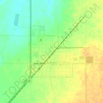
Nome: Mappa topografica Ashton, altitudine, rilievo.
Luogo: Ashton, Fremont County, Idaho, United States (44.06777 -111.45714 44.08123 -111.43578)
Altitudine media: 1.601 m
Altitudine minima: 1.585 m
Altitudine massima: 1.614 m
Fai una donazione
Preparati per la tua prossima avventura:
In qualità di associato Amazon, questo sito riceve una commissione sugli acquisti idonei senza alcun costo aggiuntivo per te.
Altre mappe topografiche
Clicca su una mappa per visualizzarne la topografia, l'altitudine e il rilievo.