
Mappa topografica Sand Point
Clicca sulla mappa per visualizzare l'altitudine.
A proposito di questa mappa
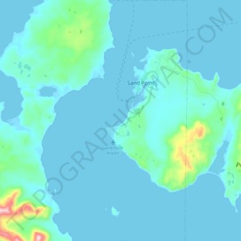
Nome: Mappa topografica Sand Point, altitudine, rilievo.
Luogo: Sand Point, Aleutians East Borough, Alaska, United States (55.26667 -160.58043 55.38337 -160.45833)
Altitudine media: 39 m
Altitudine minima: -6 m
Altitudine massima: 493 m
Altre mappe topografiche
Clicca su una mappa per visualizzarne la topografia, l'altitudine e il rilievo.
Shishaldin Volcano
United States > Alaska > Aleutians East Borough
Shishaldin is located on Unimak Island, the easternmost of the Aleutian Islands. The nearest settlement to the volcano is False Pass (population ~100) at 45 km away. The view of Shishaldin from False Pass is obscured by the Round Top and Isanotski volcanoes, preventing direct observations of eruptions in many…
Altitudine media: 2.134 m