

Mappa topografica Peers
Clicca sulla mappa per visualizzare l'altitudine.
A proposito di questa mappa
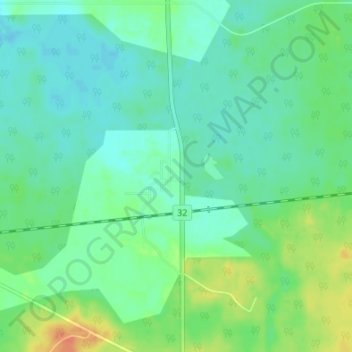
Nome: Mappa topografica Peers, altitudine, rilievo.
Luogo: Peers, Yellowhead County, Alberta, Canada (53.64692 -116.01029 53.68692 -115.97029)
Altitudine media: 850 m
Altitudine minima: 838 m
Altitudine massima: 877 m
Altre mappe topografiche
Clicca su una mappa per visualizzarne la topografia, l'altitudine e il rilievo.


Brazeau River Provincial Recreation Area
Canada > Alberta > Yellowhead County
Altitudine media: 1.325 m

Whitehorse Wildland Provincial Park
Canada > Alberta > Yellowhead County
The northern part of the park contains the watershed of the Whitehorse Creek and the ridges of foothills forming the valley for the creek. The northern ridge that bounds the Whitehorse Creek valley is the Nikanassin Range while the southern is the Miette Range. Within the park, in the Nikanassin Range are four…
Altitudine media: 1.951 m

William A. Switzer Provincial Park
Canada > Alberta > Yellowhead County
This park is situated within the foothills of Alberta's Rocky Mountains, at an elevation of 1,150 m (3,770 ft) to 1,300 m (4,300 ft) and has a surface of 93 km2 (36 sq mi). It was established on December 22, 1958 and is maintained by Alberta Tourism, Parks and Recreation. The park is named after former…
Altitudine media: 1.348 m