

Mappa topografica Bilimora
Clicca sulla mappa per visualizzare l'altitudine.
Bilimora
Bilimora is located at 20°45′N 72°57′E / 20.75°N 72.95°E / 20.75; 72.95. It has an average elevation of 4 metres (13 ft). Bilimora is the second largest city in the Navsari district after Navsari city. The city is supposed to have been surrounded by three rivers: Ambika from the north, Kaveri river from the south, and the Karera river passes close by.
A proposito di questa mappa
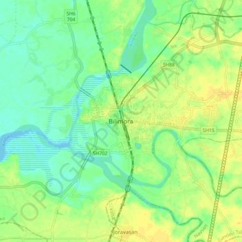
Nome: Mappa topografica Bilimora, altitudine, rilievo.
Luogo: Bilimora, Gandevi Taluka, Navsari, Gujarat, 396321, India (20.72717 72.92935 20.80717 73.00935)
Altitudine media: 11 m
Altitudine minima: -4 m
Altitudine massima: 22 m