Fai una donazione
Preparati per la tua prossima avventura:
In qualità di associato Amazon, questo sito riceve una commissione sugli acquisti idonei senza alcun costo aggiuntivo per te.
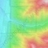
Mappa topografica Logan
Clicca sulla mappa per visualizzare l'altitudine.
Fai una donazione
Preparati per la tua prossima avventura:
In qualità di associato Amazon, questo sito riceve una commissione sugli acquisti idonei senza alcun costo aggiuntivo per te.
Logan
The city lies near the eastern edge of Cache Valley on the western slopes of the Bear River Mountains. Mount Logan rises to an elevation of 9,710 feet (2,960 m) immediately to the east, and south of Logan Canyon. The eastern portions of the city are atop shelf-like "benches", late Pleistocene sedimentary deposits created by the glacially fed Logan River feeding into the northern stretches of Lake Bonneville, building a "Gilbert-type" river delta over several thousand years. The Logan River later cut down through these sedimentary deposits after the draining of Lake Bonneville about 14,500 years ago. This created a low-lying area with very steep slopes that reach into the rest of town and to the Logan River bottomlands. West of Logan lie flatlands that contain both farmland and marshes. North and south of Logan are rapidly growing residential suburbs.
Fai una donazione
Preparati per la tua prossima avventura:
In qualità di associato Amazon, questo sito riceve una commissione sugli acquisti idonei senza alcun costo aggiuntivo per te.
A proposito di questa mappa
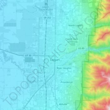
Nome: Mappa topografica Logan, altitudine, rilievo.
Luogo: Logan, Cache County, Utah, United States (41.67538 -111.90194 41.79736 -111.78019)
Altitudine media: 1.498 m
Altitudine minima: 1.342 m
Altitudine massima: 2.659 m
Fai una donazione
Preparati per la tua prossima avventura:
In qualità di associato Amazon, questo sito riceve una commissione sugli acquisti idonei senza alcun costo aggiuntivo per te.
Altre mappe topografiche
Clicca su una mappa per visualizzarne la topografia, l'altitudine e il rilievo.
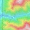
Logan Canyon
United States > Utah > Cache County
Logan Canyon is a canyon in the western United States in northeastern Utah, which cuts its way through the Bear River Mountains, a branch of the Wasatch Range. It is popular for both summer and winter activities, especially rock-climbing, hiking, camping, fishing, snowmobiling, and skiing, at the Beaver…
Altitudine media: 1.780 m

Fai una donazione
Preparati per la tua prossima avventura:
In qualità di associato Amazon, questo sito riceve una commissione sugli acquisti idonei senza alcun costo aggiuntivo per te.