
Mappa topografica Lake Highlands
Mappa interattiva
Clicca sulla mappa per visualizzare l'altitudine.
A proposito di questa mappa
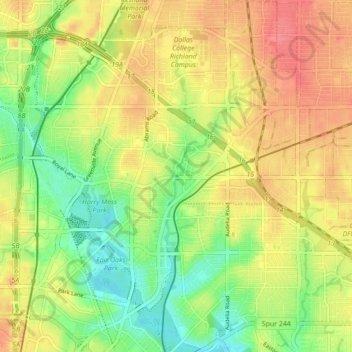
Nome: Mappa topografica Lake Highlands, altitudine, rilievo.
Altitudine media: 175 m
Altitudine minima: 141 m
Altitudine massima: 206 m
The neighborhood differs from much of Dallas and the surrounding area, which is fairly flat. Lake Highlands has hills and valleys, with street elevations that can vary by 50 feet, which offer scenic views of downtown Dallas.