

Mappa topografica Khrew
Clicca sulla mappa per visualizzare l'altitudine.
Khrew
Khrew is located at 34°01′12″N 74°59′24″E / 34.020°N 74.99°E / 34.020; 74.99. It has an average elevation of 1,607 metres (5,272 feet) and is located in the Kashmir valley. The area starts from Babapora to Seer Bagh and from Bathen to Androosa. Also, the foot region is extended to Ladhoo, a village in Jammu and Kashmir.
A proposito di questa mappa
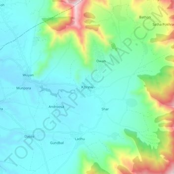
Nome: Mappa topografica Khrew, altitudine, rilievo.
Luogo: Khrew, Pampore, Pulwama, Jammu and Kashmir, 191102, India (33.97985 74.95954 34.05985 75.03954)
Altitudine media: 1.788 m
Altitudine minima: 1.589 m
Altitudine massima: 2.493 m