
Fai una donazione
Preparati per la tua prossima avventura:
In qualità di associato Amazon, questo sito riceve una commissione sugli acquisti idonei senza alcun costo aggiuntivo per te.
Mappa topografica Snake River
Clicca sulla mappa per visualizzare l'altitudine.
Fai una donazione
Preparati per la tua prossima avventura:
In qualità di associato Amazon, questo sito riceve una commissione sugli acquisti idonei senza alcun costo aggiuntivo per te.
Snake River
Mountain ranges in the Snake watershed include the Teton Range, Bitterroot Range, Clearwater Mountains, Seven Devils Mountains, and the extreme northwestern end of the Wind River Range. Grand Teton is the highest point in the Snake River watershed, reaching 13,775 feet (4,199 m) in elevation. The elevation of the Snake River is 358 feet (109 m) when it joins the Columbia River.[3]
Fai una donazione
Preparati per la tua prossima avventura:
In qualità di associato Amazon, questo sito riceve una commissione sugli acquisti idonei senza alcun costo aggiuntivo per te.
A proposito di questa mappa
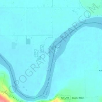
Nome: Mappa topografica Snake River, altitudine, rilievo.
Luogo: Snake River, Washington County, Idaho, United States (44.24055 -117.04422 44.24207 -117.04351)
Altitudine media: 643 m
Altitudine minima: 635 m
Altitudine massima: 721 m
Fai una donazione
Preparati per la tua prossima avventura:
In qualità di associato Amazon, questo sito riceve una commissione sugli acquisti idonei senza alcun costo aggiuntivo per te.
Altre mappe topografiche
Clicca su una mappa per visualizzarne la topografia, l'altitudine e il rilievo.
Cambridge
United States > Idaho > Washington County
Cambridge is located at 44°34′18″N 116°40′41″W / 44.57167°N 116.67806°W / 44.57167; -116.67806 (44.571535, −116.678013), at an elevation of 2,661 feet (811 m) above sea level. According to the United States Census Bureau, the city has a total area of 0.49 square miles (1.27 km2), of…
Altitudine media: 811 m
Midvale
United States > Idaho > Washington County
Midvale is at an elevation of 2,543 feet (775 m) above sea level.
Altitudine media: 794 m