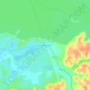
Mappa topografica Mountain House
Clicca sulla mappa per visualizzare l'altitudine.
Mountain House
Mountain House lies on the foothills of the Diablo Range, and close to the Altamont Pass which is over 1,000 feet (300 m) in elevation. It is on the border of Alameda and Contra Costa counties. According to the United States Census Bureau, the CDP covers an area of 3.2 square miles (8.3 km2), all of it land. The census definition of the area may not precisely correspond to local understanding of the area with the same name. The community is bisected by Mountain House Creek. Mountain House Creek originates south of the Altamont Pass and Interstate 580, flowing northeasterly along and crossing under the interstate, then along Grant Line Road to the intersection with Mountain House Road at the historic Alameda County Mountain House. The creek continues northeasterly through the residential communities of Mountain House before emptying into the Old River, a distributary of the San Joaquin River.
A proposito di questa mappa

Nome: Mappa topografica Mountain House, altitudine, rilievo.
Altitudine media: 24 m
Altitudine minima: -3 m
Altitudine massima: 147 m
Altre mappe topografiche
Clicca su una mappa per visualizzarne la topografia, l'altitudine e il rilievo.

Shumway Oak Grove Regional Park
United States > California > San Joaquin County > Stockton
Altitudine media: 3 m

River Islands
United States > California > San Joaquin County > Lathrop > River Islands
Altitudine media: 4 m



Lodi
United States > California > San Joaquin County
Lodi is flat terrain at an elevation of approximately 50 feet (15 m) above mean sea level datum. Historically, land in the area has been used for grazing as well as for grain production.
Altitudine media: 3 m